
New map application: four out of five people could walk to their nearest kindergarten, primary school and library
The Land and Spatial Development Board, the Ministry of Regional Affairs and Agriculture, the Foresight Centre and Statistics Estonia have created a map application of public services. Anyone can use this to find out how far the nearest kindergarten, school, family doctor and other public services are from their home.
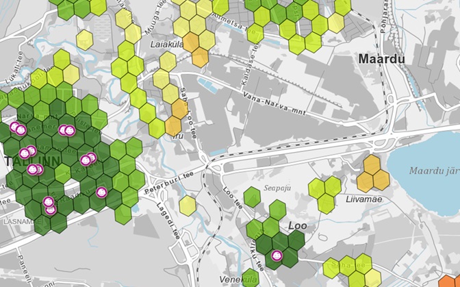
The Land and Spatial Development Board’s map application displays government, municipal and private services such as kindergartens, schools, youth centres, family doctors, libraries and cultural centres. For each service, it is possible to check where and how far away, in kilometres or time, its potential users live. The analysis uses real road network data.
The map application shows that nearly 90% of residents of Estonia are located mostly less than three kilometres away from basic educational, health and cultural services. Kindergartens, schools and libraries are the most accessible.
Eneli Kindsiko, expert at the Foresight Centre, said that compared to other European countries, public services are easily accessible in Estonia. “In scientific literature, a reasonable distance is considered to be 5–10 kilometres, and in Estonia, we can see that the average distance of all observed services is less than five kilometres from the location of residents,” said Kindsiko. “However, it varies widely between municipalities. For instance, the students of Peipsiääre rural municipality have the longest average journey to their closest upper secondary school – 36 kilometres.”
Compared to other European Union countries, Estonia stands out for its very good accessibility to kindergarten services. In Estonia, kindergartens are located on average 1.5 kilometres from the homes of residents and the closest kindergarten is less than two kilometres away or potentially within walking distance for four out of five children.
74% of Estonian residents live less than three kilometres from the nearest family doctor. At the same time, the availability of family doctor services is uneven across regions, as in smaller and sparsely populated areas, and the family doctor lists are often smaller than optimal and therefore the family doctor clinics may lack the staff to remain open at all times.
Approximately 80% of primary and basic school pupils live less than three kilometres from the nearest school and they could reach it on foot. In Estonia, the upper secondary school network is sparser and only 67% of students live within three kilometres of their closest school. At the same time, upper secondary school students are more independent and mobile and they would often consciously choose an upper secondary school that is located further away: they prefer the school that offers better education, a specific field of study, or better preparation for university.
A library is located less than three kilometres away for nearly 80% of Estonian residents. Although in the last 35 years, the number of public libraries has decreased by a quarter in Estonia, their network is still one of the densest in the European Union. Community, cultural or social centres are located less than three kilometres away for 67% of residents.
Three quarters of Estonian young people live less than three kilometres from a youth centre. The problem with the centres is their low visitor numbers, however. Typically, a youth centre is visited by 11–20 youths a day and the annual number of individual visitors to most youth centres remains below 300.
The Foresight Centre shows in its new research stream ‘The Future of Accessibility of Local Public Services’ that although there is a dense service network in Estonia, many residents don’t use the services closest to their home. For instance, nearly half of kindergarten children go to a kindergarten that is further than the one nearest to home. The same can be said about schools and family doctor services.
The completed map application also highlights the areas that are most accessible to people. Additionally, the application allows data-based planning of new service provision points in the areas where the need for services is greatest. The places where there are too few service users become apparent as well.
According to Holger Ehrlich, chief specialist of the Local Government Policy Department at the Ministry of Regional Affairs and Agriculture, these data are key in evaluating the services of municipalities. “Often, it is believed that the network of services is disorganised and inefficient in sparsely populated municipalities,” he said. “So far, such assessments have only been assumptive. Now we can make conclusions based on real data.” However, Ehrlich pointed out that in sparsely populated areas, it is not possible to achieve as efficient use of resources as in cities and more densely populated areas, since the distances between the service provision points would become too long.
The map application was developed by the Land and Spatial Development Board at the request of the Foresight Centre and the Ministry of Regional Affairs and Agriculture. It is available on the Land and Spatial Development Board’s website (in Estonian).
The map application was developed as part of the Foresight Centre’s research stream ‘The Future of Accessibility of Local Public Services. Trends and Scenarios up to 2050’. The purpose of the research stream is to map the accessibility of public services now and in the future and discern the most suitable future models of service provision. The research stream report is available on the Foresight Centre’s website (in Estonian).
Latest news
-
11.03 2026Study: Youth can be entrusted to make important decisions at a younger age
A study conducted by the University of Tartu on behalf of the Foresight Centre showed that expanding the decision-making rights of young people may be highly desirable for society, as the youth of today are for the most part prepared to make complex decisions from the age of 16. However, the environment in which decisions are made strongly influences the quality of young people’s decisions.